Drone survey services
Clear aerial data for construction sites and project teams
From orthomosaic maps to interactive panoramas, point clouds, 3D models and progress updates, we help you see, understand and record your site from above.
What we do
Drone outputs that make your site easier to understand
Drone data is most useful when it gives your team something practical to work with.
We produce visual site outputs that support planning, reporting, communication and progress records. Whether you need a clear top-down map, an interactive panorama or regular aerial updates, the aim is the same: make the site easier to see and easier to explain.
- Better visibility across the whole project
- Clearer progress records and site updates
- Useful visual evidence for reports and discussions
- A safer way to review hard-to-access areas from above
Services
Choose the drone output that fits your project
Each service gives you a different way to view, measure, record or communicate your site.
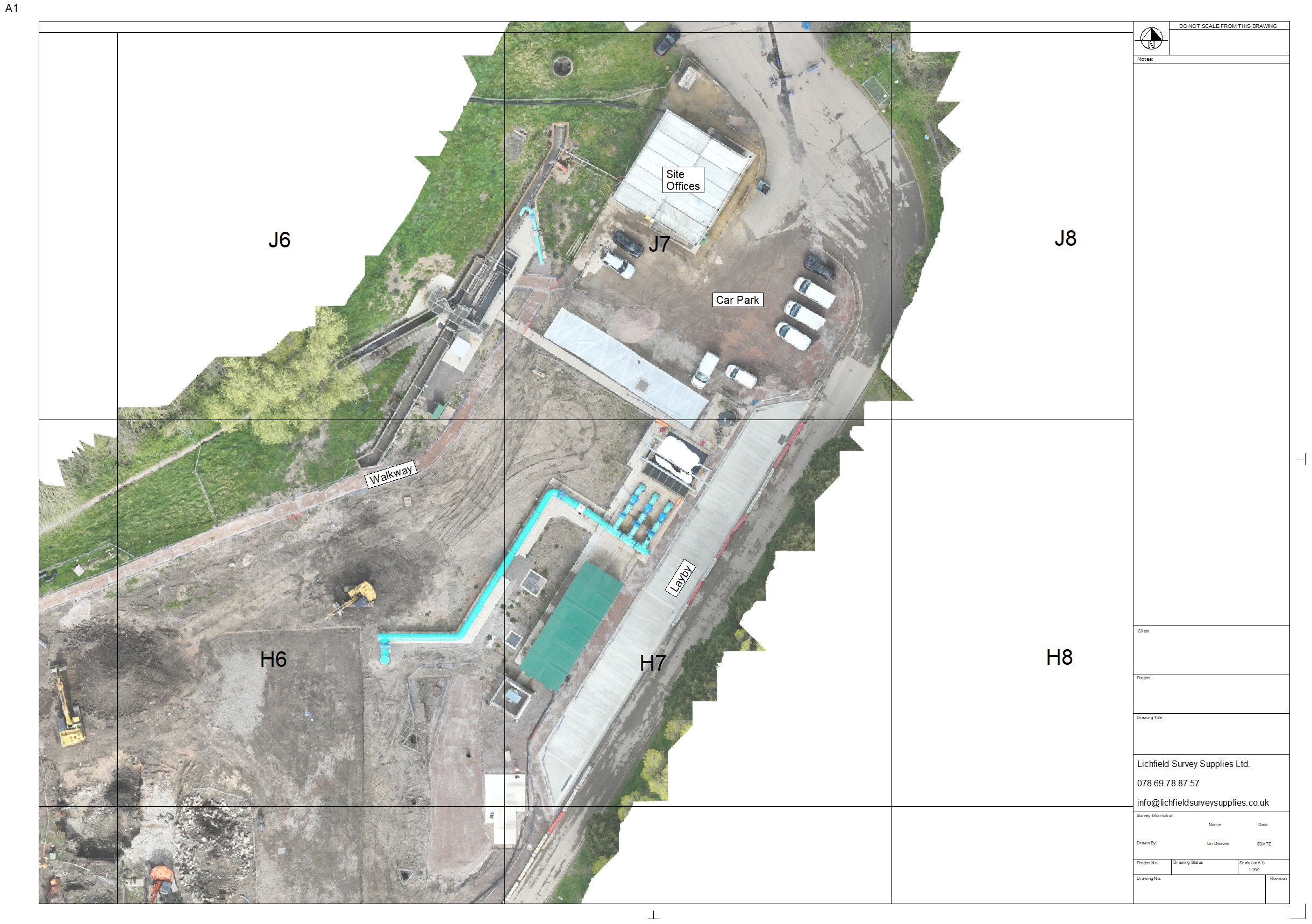
Orthomosaics
Create a clear, measurable top-down map of your site. Useful for planning, progress tracking, site records and evidence of completed work.
Learn about orthomosaics →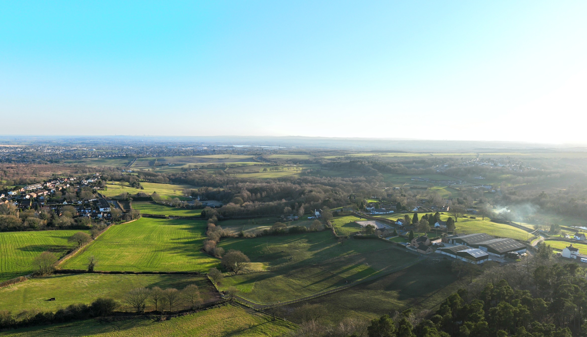
Panoramas
Give clients, stakeholders or team members an interactive view of a location without needing to be on site.
View panorama service →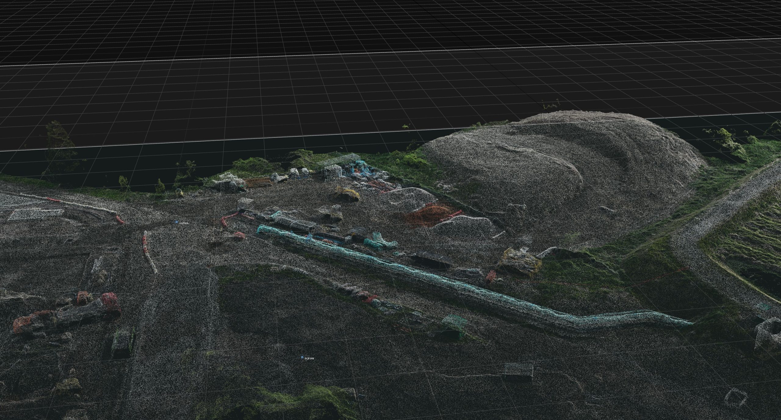
Point Clouds
Use spatial site data to review shape, levels and detail in a more technical way. Helpful for modelling, comparison and measurement workflows.
Ask about point clouds →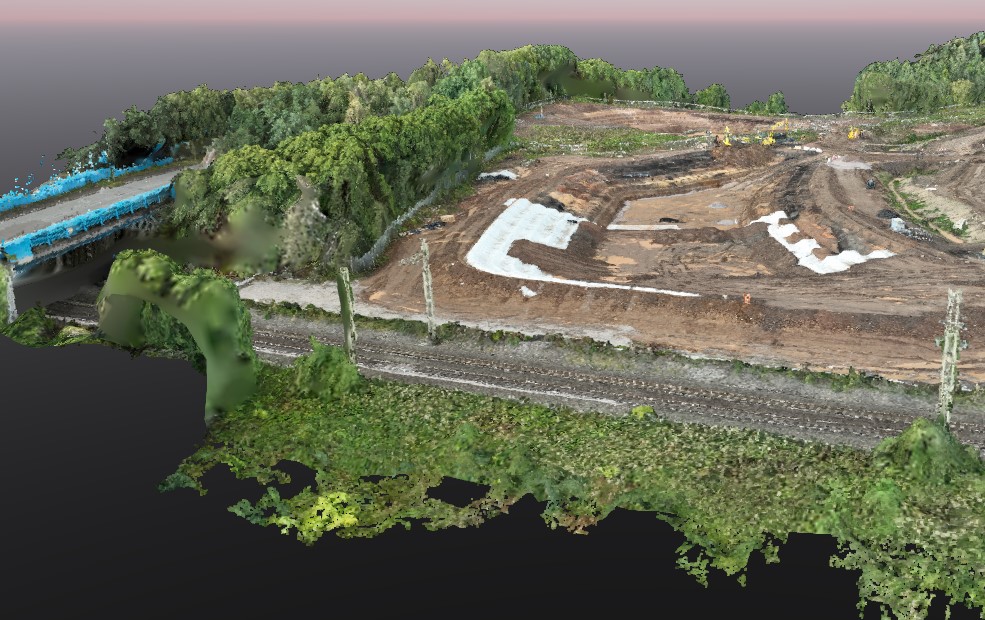
3D Models
Turn site imagery into a 3D visual model that helps people understand the project, structure or landscape more clearly.
Ask about 3D models →
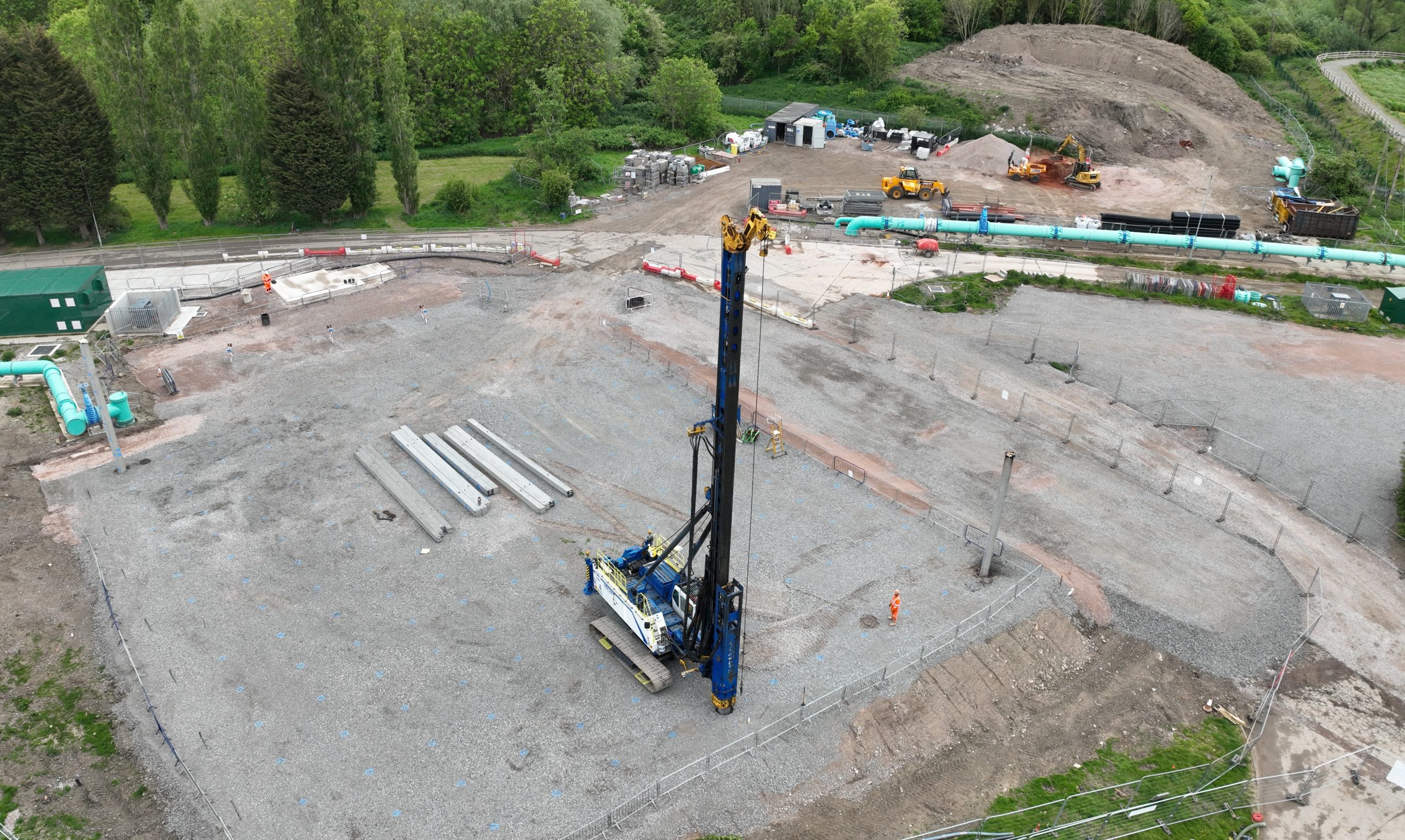
Aerial Images and Videos
Capture professional aerial footage for project records, client updates, marketing, presentations and visual reporting.
Ask about aerial media →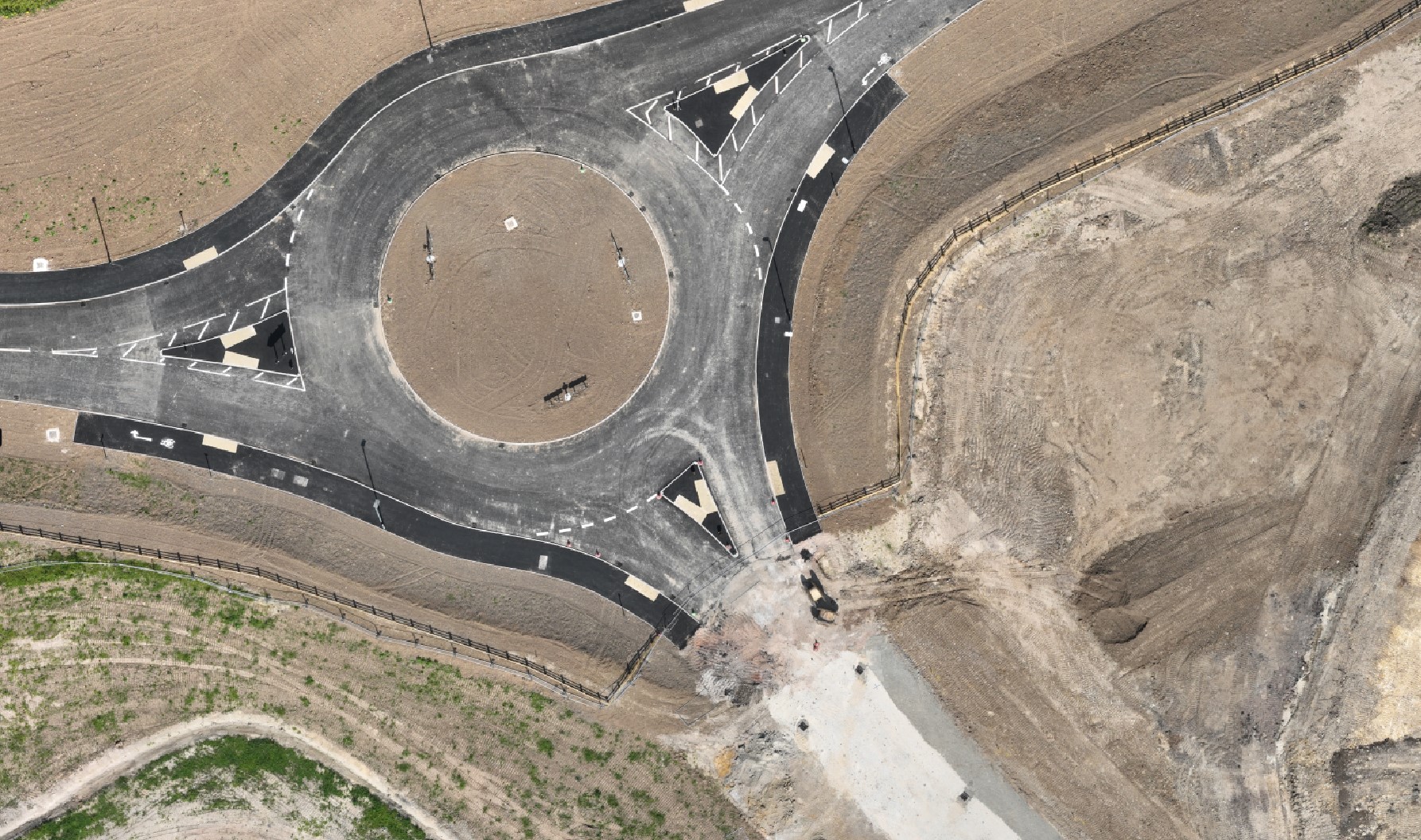
Construction Site Updates
Build a regular aerial record of your project so progress can be reviewed, compared and shared with the wider team.
Plan site updates →Which service do you need?
Start with the problem you are trying to solve
If you are not sure which output is right, this simple guide can help.
I need to see the whole site clearly
An orthomosaic is usually the best starting point. It gives you a clear top-down view of the project.
I need to show progress over time
Construction site updates and aerial progress photography help you build a visual project record.
I need stakeholders to view the location remotely
A panorama gives people an interactive way to understand the surrounding site and landscape.
I need more technical survey data
Point clouds and 3D models can support measurement, modelling and deeper site analysis.
I need visual content for reports or marketing
Aerial images and videos give you polished visual material for updates, presentations and online content.
I am not sure what I need yet
Send your site details and we can suggest the most useful output based on your project, location and goal.
Why Surveyed By Drone
Practical drone data, captured with site work in mind
Surveyed By Drone is operated by Lichfield Survey Supplies Ltd and focuses on useful aerial outputs for construction sites, project teams and site-based work.
We are Midlands based, GVC qualified and hold CAA Operational Authorisation.
Useful when you need to:
- Plan site activities with a clearer view
- Share visual progress with clients or teams
- Support reporting with aerial evidence
- Create a record of site changes over time
- Review areas that are difficult to understand from ground level
Request a quote
Not sure which drone output you need?
Tell us about your site and what you are trying to achieve. We will advise which output is likely to be most useful.