Drone surveys and orthomosaics for construction sites
See your construction site clearly from above
Get accurate drone orthomosaics, aerial images, point clouds and 3D models that help you plan work, track progress and provide visual evidence of what has been completed.
The problem
Ground-level views only tell part of the story
On a busy construction site, it is not always easy to see what has changed, what is complete, and what still needs attention.
When you do not have a clear view of the whole site, planning becomes harder. Progress can be missed. Payment applications can lack visual evidence. Teams end up relying on guesswork.
- Hard to see the whole project in one view
- Difficult to prove work completed from ground photos alone
- Planning decisions made from incomplete information
- Progress updates that are slow, unclear or hard to compare
The solution
Turn your site into a clear, measurable map
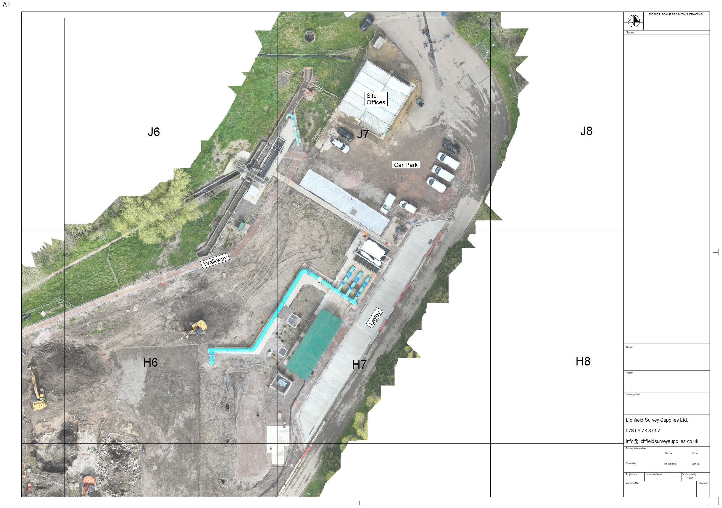
An orthomosaic is a high-resolution aerial map created from many drone images stitched together into one accurate view.
It gives site teams, engineers, project managers and clients a simple way to understand the project from above — without needing to walk every corner of the site.
Surveyed By Drone captures and processes the data, so you get useful visual outputs that support better planning, clearer communication and stronger project records.
What we provide
Drone survey outputs your team can actually use
Clear aerial data for construction planning, progress tracking, reporting and project communication.
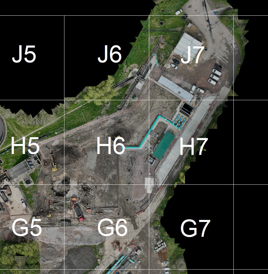
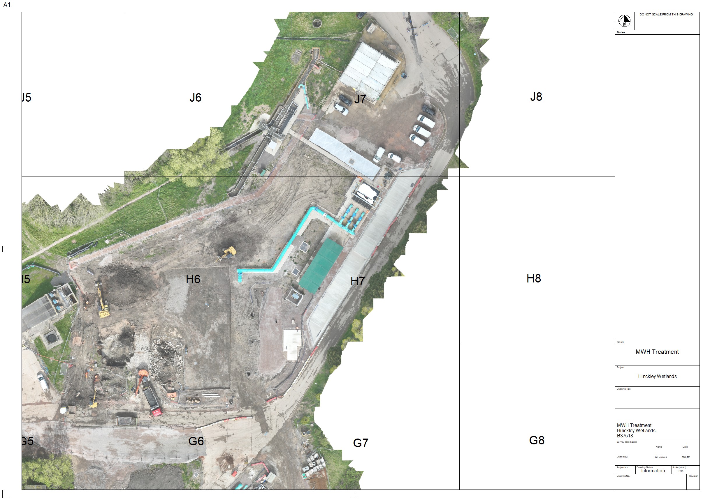
Orthomosaic Maps
See the whole site in one detailed, measurable aerial view. Ideal for planning, progress records and site communication.
Progress Photography
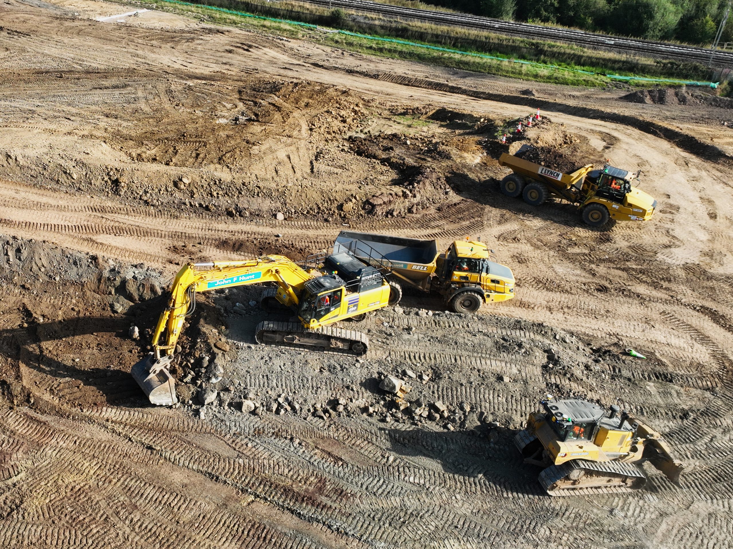
Capture regular aerial images and videos to show how the project is changing over time.
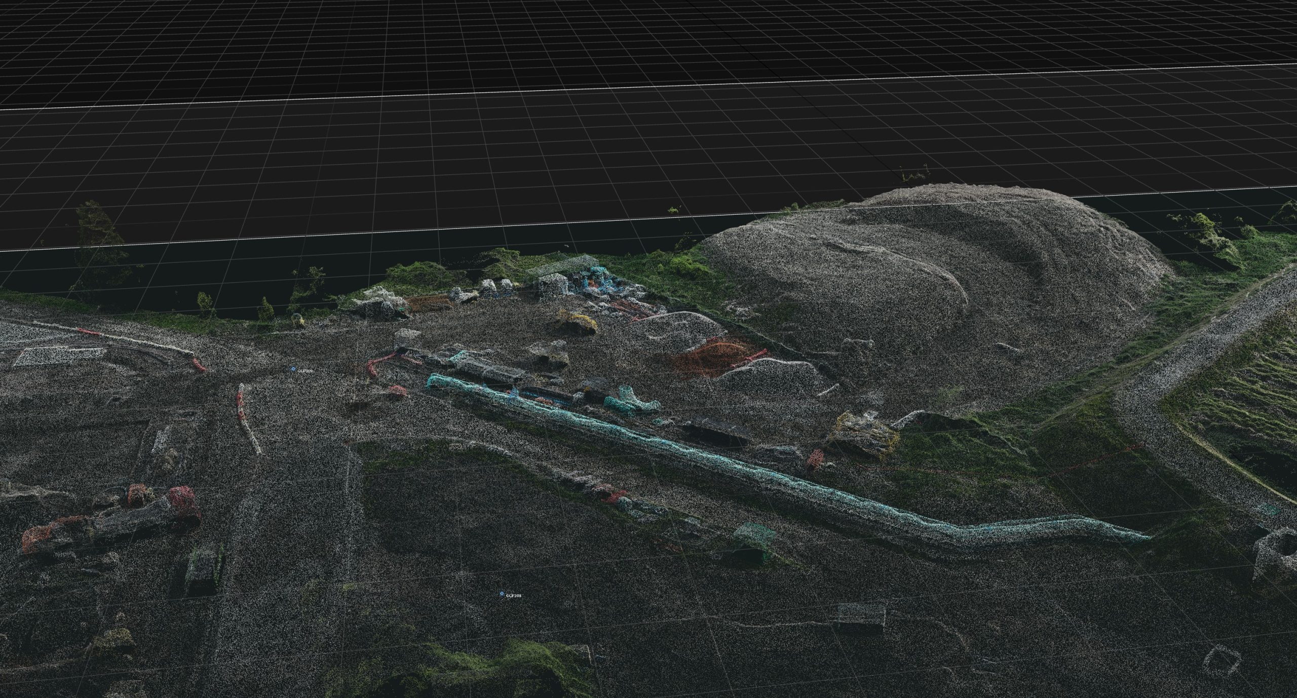
Point Clouds
Create spatial data that can support measurement, modelling and deeper site analysis.
3D Models
Help stakeholders understand the site visually with 3D outputs that are easy to review and share.
Aerial Images & Video
Professional drone media for reporting, client updates, marketing and project records.
Construction Site Updates
Build a clear visual timeline of your site so progress can be reviewed and compared over time.
Example outputs
Outputs That Help You Plan, Prove and Progress
Drone surveys can produce more than aerial photographs. They can create clear, practical outputs that help your team understand the site, track progress and communicate what is happening on the ground. From orthomosaic maps to point clouds and progress photography, each output gives you a different way to see, measure and record your project.
Why work with us
Built around safe, compliant drone operations
Surveyed By Drone is part of Lichfield Survey Supplies Ltd and focuses on practical drone outputs for construction and site-based projects.
We understand that construction sites need safe working, clear communication and usable deliverables — not just attractive aerial footage.
Simple process
From site details to usable aerial data
Tell us about your site
Send the location, approximate size, access details and what you need the output for.
We plan and capture the data
We review the site, plan the flight safely and capture the images needed for your outputs.
You receive clear outputs
You get visual site data that can be used for planning, communication and project records.
Common uses
Where an orthomosaic helps most
An orthomosaic is especially useful when teams need a clear record of the project at a specific point in time.
- Planning site activities and access routes
- Reviewing earthworks, compounds and haul roads
- Showing completed work for reports or payment applications
- Giving clients and stakeholders a clear project update
- Comparing progress between different survey dates
Request a quote
Need an orthomosaic of your site?
Send us a few details and we will advise what is possible, what we need, and the best way to capture your site.
No pressure — just a practical conversation about your project and the outputs that would be most useful.
Tell us about your site
FAQ
Questions before you enquire?
These answers are written to remove last-minute doubts before someone gets in touch.
How quickly can we get an orthomosaic?
Timelines depend on site size, weather, permissions and processing requirements. Once we know the site details, we can advise the likely turnaround.
Can you work on construction sites?
Yes. We understand that construction sites require safe planning, communication and compliance. We hold GVC qualification and CAA Operational Authorisation.
What do you need from us to quote?
We usually need the site location, approximate area, access information, required output and how you plan to use the data.
Do you only cover the Midlands?
We are Midlands based and can travel further afield where required, depending on the project.
Clarity from above
Ready to see your site clearly?
Get a clear aerial view of your project with drone orthomosaics and site data built for construction teams.